


JOHANNES VAN KEULEN - CHART / MAP, southern part of the Baltic Sea, Amsterdam 1697 - 1709
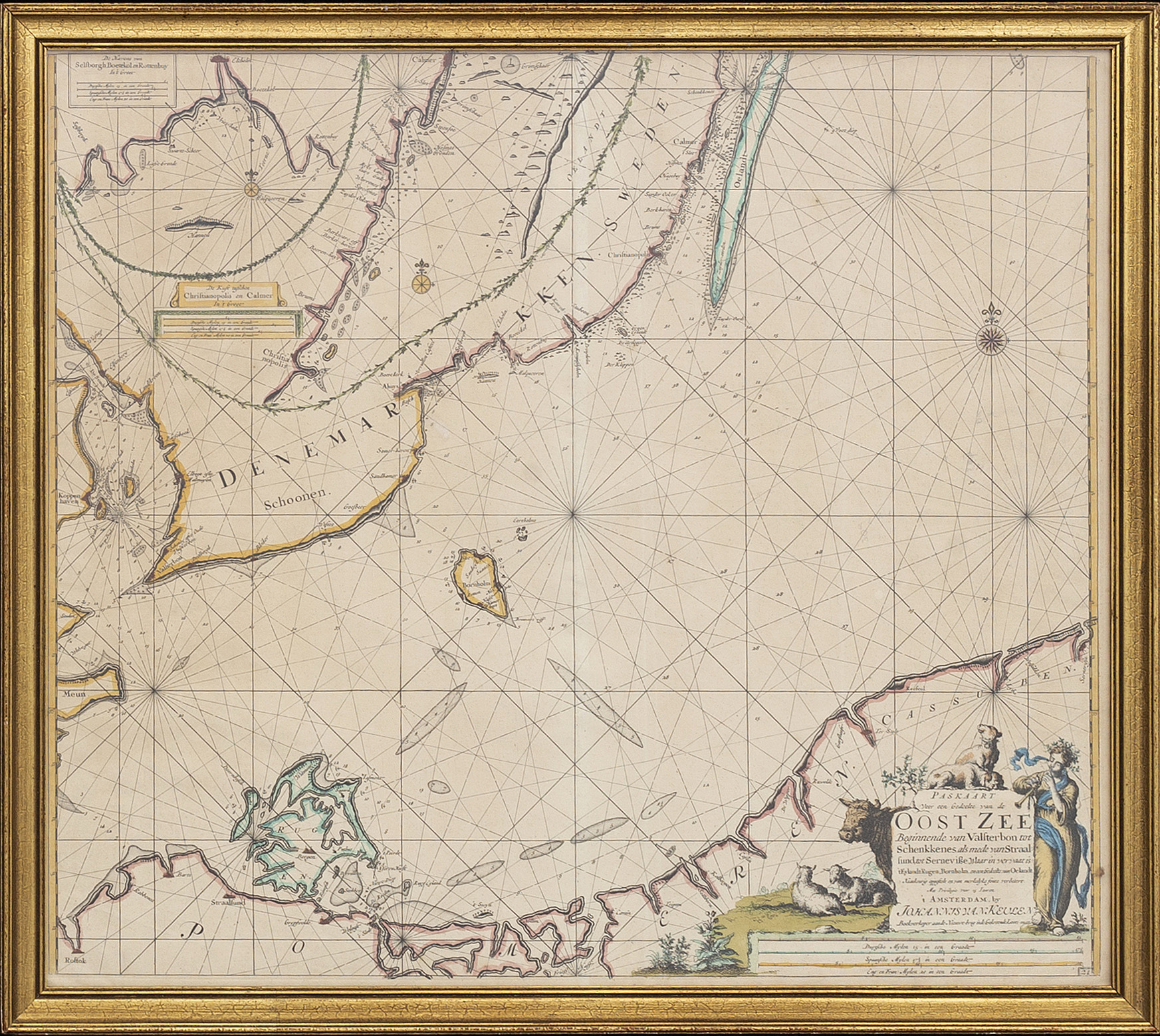


JOHANNES VAN KEULEN - CHART / MAP, southern part of the Baltic Sea, Amsterdam 1697 - 1709
'Paskaart voor een Gedeelte van de Oost Zee Beginnende van Valsterbon tot Schenkkenes als mede van Stralsund ... Rugen, Bornholm, en een Gedeelte van Oelandt...' Two insets. hand colored copper engraving. 51,5 x 58,5 cm.
Wear due to age and use. Slightly time stained. Minor stains. Fold. Not examined out of frame.
Purchasing info
Contact

Customer service
Please contact Customer Support for inquiries regarding transport, payment and other questions.
Sweden
Telephone hours: Monday – Friday 9 am – 1 pm
+46 8-614 08 00
Finland
Telephone hours: Monday – Friday 9 am – 1 pm
+358-9-668 91 10
Others have also viewed
4d 1h
Steve Crist's book "Edward Weston: One Hundred Twenty-Five Photographs".
No bids
Estimate 2 500 SEK
5d 2h
Johann Baptist Homann, map of southern Norway, copper engraving Nuremberg 1729.
No bids
Estimate 3 000 SEK
7d 2h
Ando Utagawa Hiroshige, after, "Ishibe".
No bids
Estimate 4 000 SEK
3d 22h
Georg Braun & Franz Hogenberg, city view of Lund, hand-coloured copper engraving, Cologne 1588.
Current bid 2 200 SEK
Estimate 3 000 SEK