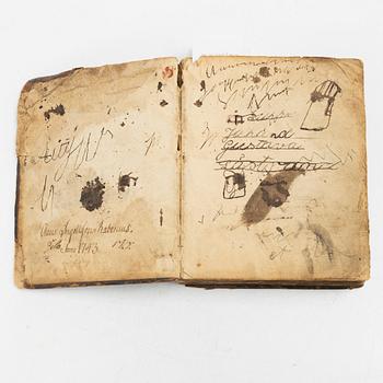
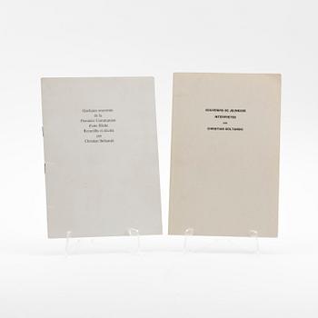
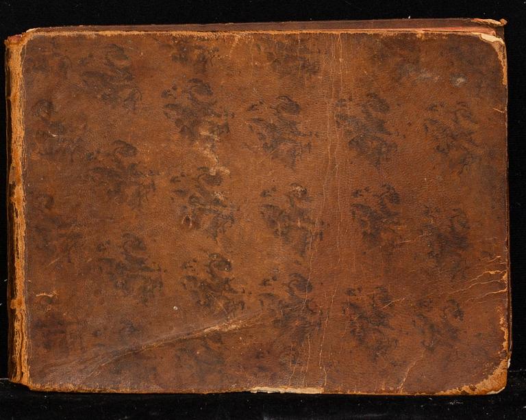
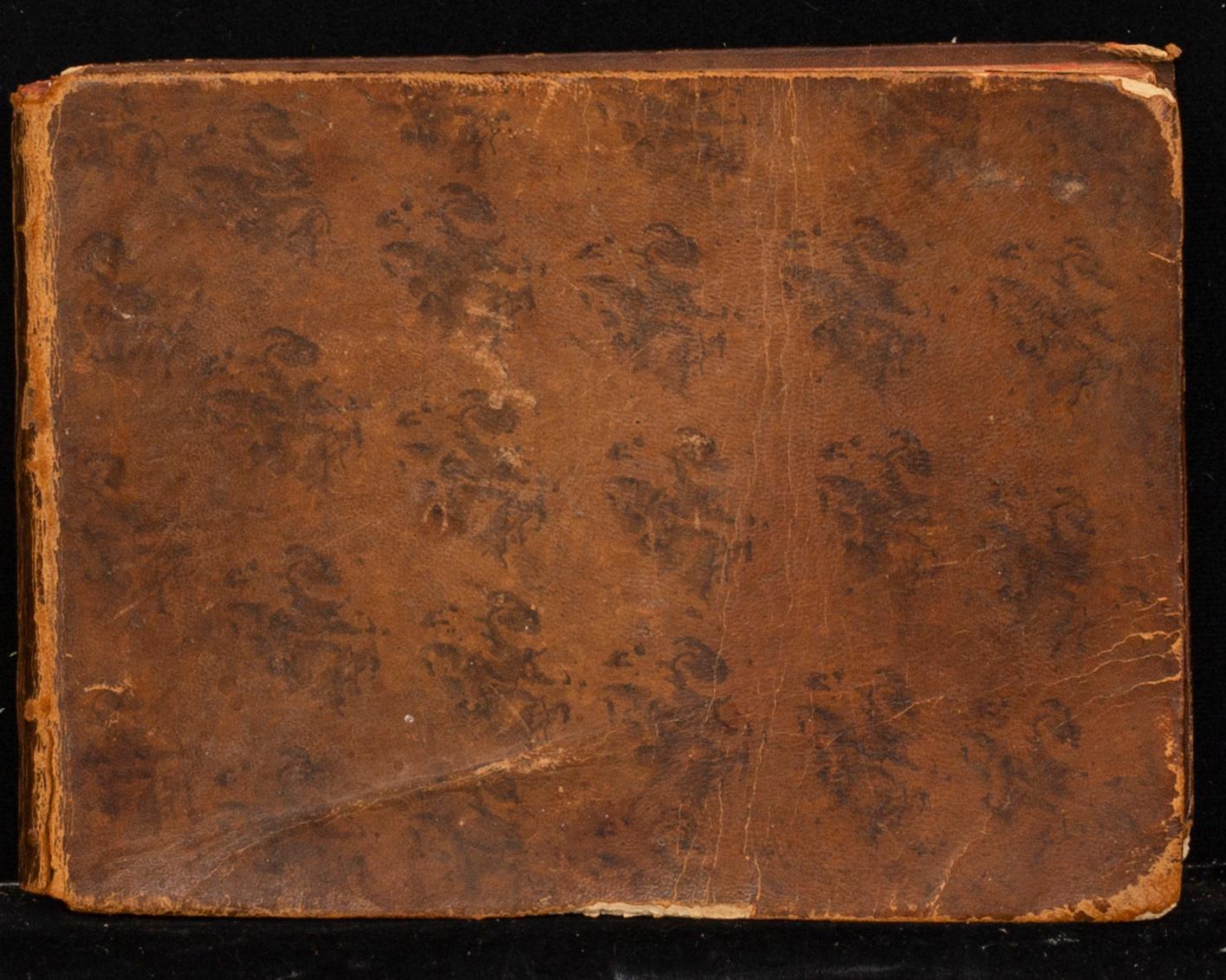
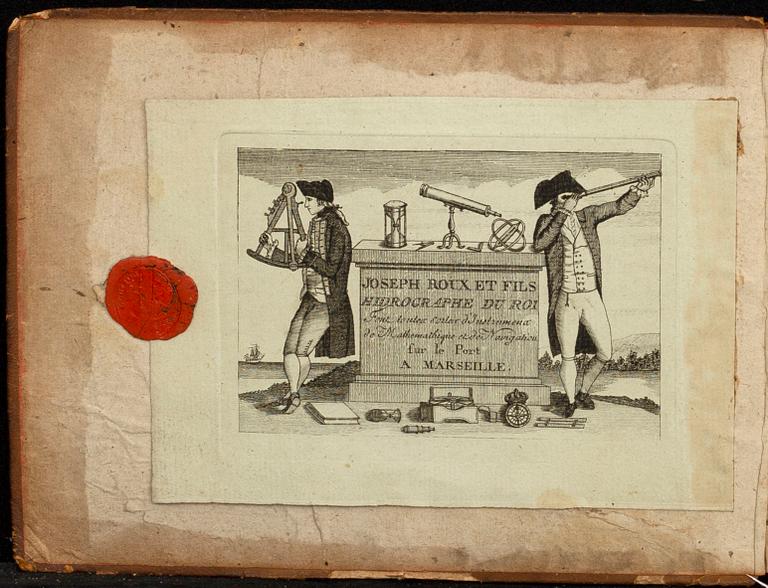
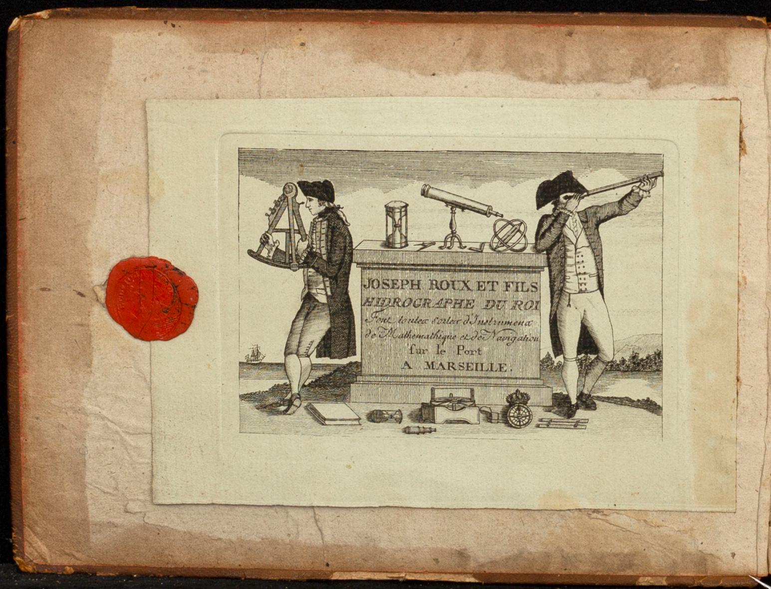
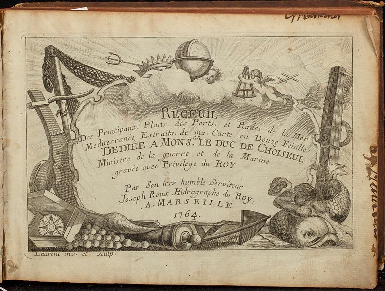
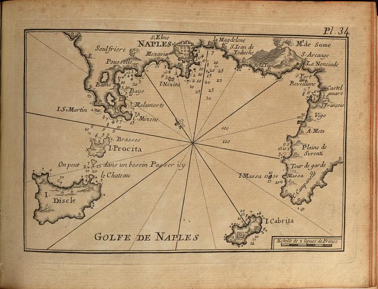
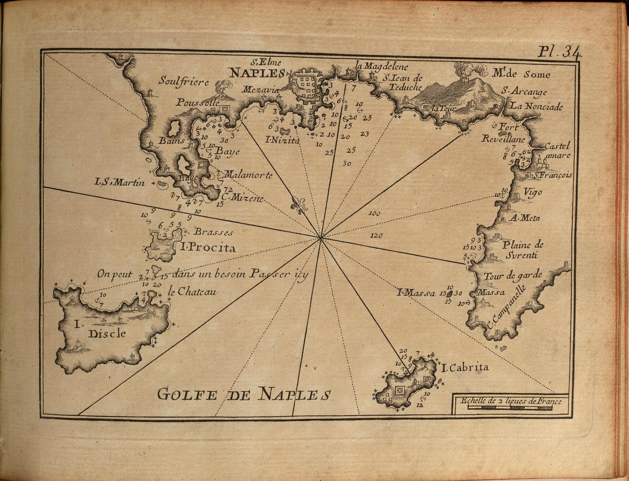
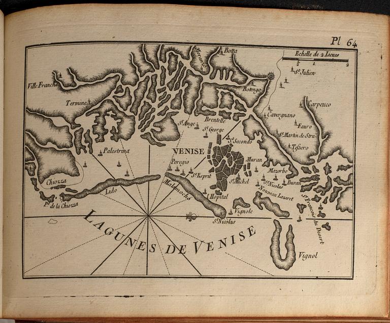
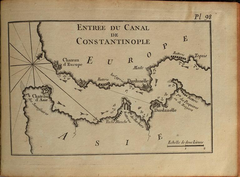
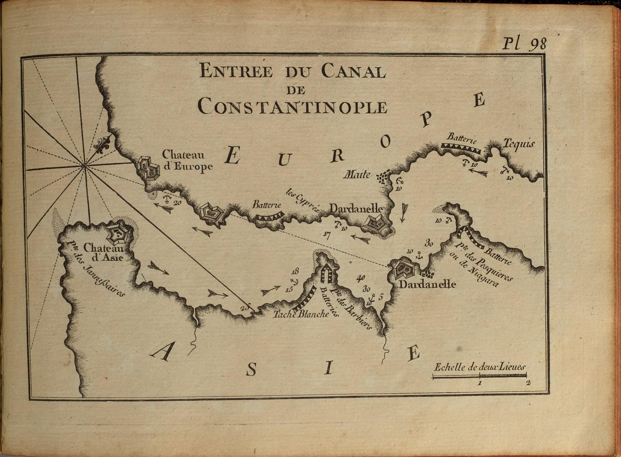
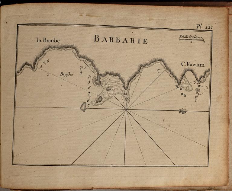
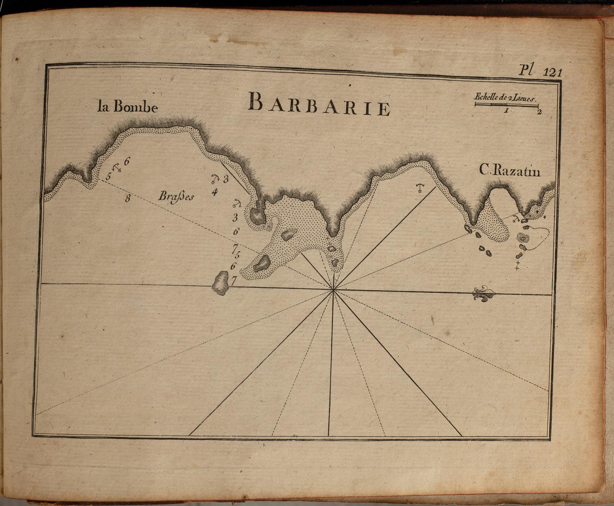
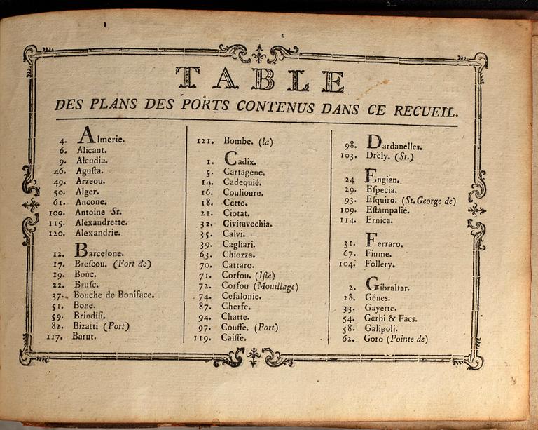
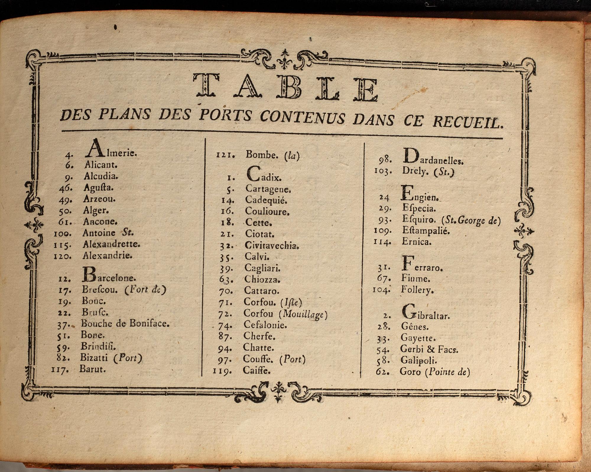
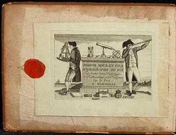
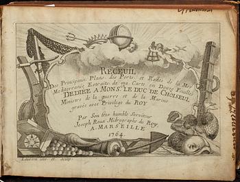
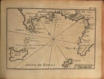
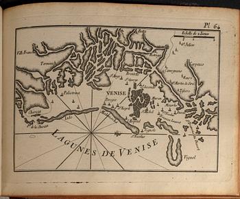
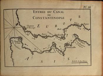
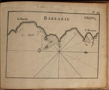
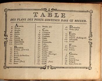
'Receuil Des Principaux Plans des Ports, et Rades de la Mer Mediterranée, Estraits de ma Carte en Douze Feuilles / Dediée a Monsgr. le Duc de Choiseul Ministre de la guerre et de la Marine gravée avec Privilege du Roy / Par son tres humble Serviteur Joseph Roux Hidrographe du Roy. A Marseille / 1764'. Contains 121 charts / maps of ports in the Mediterranean. First edition. Oblong 8vo (17,5 x 24 cm.) in a contemporary marbled full leather binding with mute spine and red edges. Binding rubbed and with wear to extremities, though a tight binding. Contemporary names in margin and recto on the title page. and on two other maps/plans. A small number of plates mildly browned, occasional rare spots. Several plans printed on thicker blue toned paper. Cc. [1 engraved title page, 'Laurent inv./sculp.'], 121 [plates], pp.2 (index). The engraved trade card of the Roux family's hydrographic shop, 'Sur le Port de Marseille', is fitted on the inside of the front cover.
Wear due to age and use. A small number of plates mildly browned, occasional rare spots. Several plans printed on thicker blue toned paper. Contemporary names on edges, in the margins and recto of the title page and also recto on two other charts / maps. Binding rubbed and with wear to extremities, damages.
Ota yhteyttä

Asiakaspalvelu
Olethan yhteydessä asiakaspalveluumme, mikäli sinulla on kysymyksiä liittyen kuljetukseen, maksuun tai muihin asioihin.
Ruotsi
Puhelin maanantai – perjantai klo 9–12
+46 8-614 08 00
Suomi
Puhelin maanantai - perjantai klo 10–13
+358-9-668 91 10
Tietoa ostamisesta


Muiden katsomia kohteita