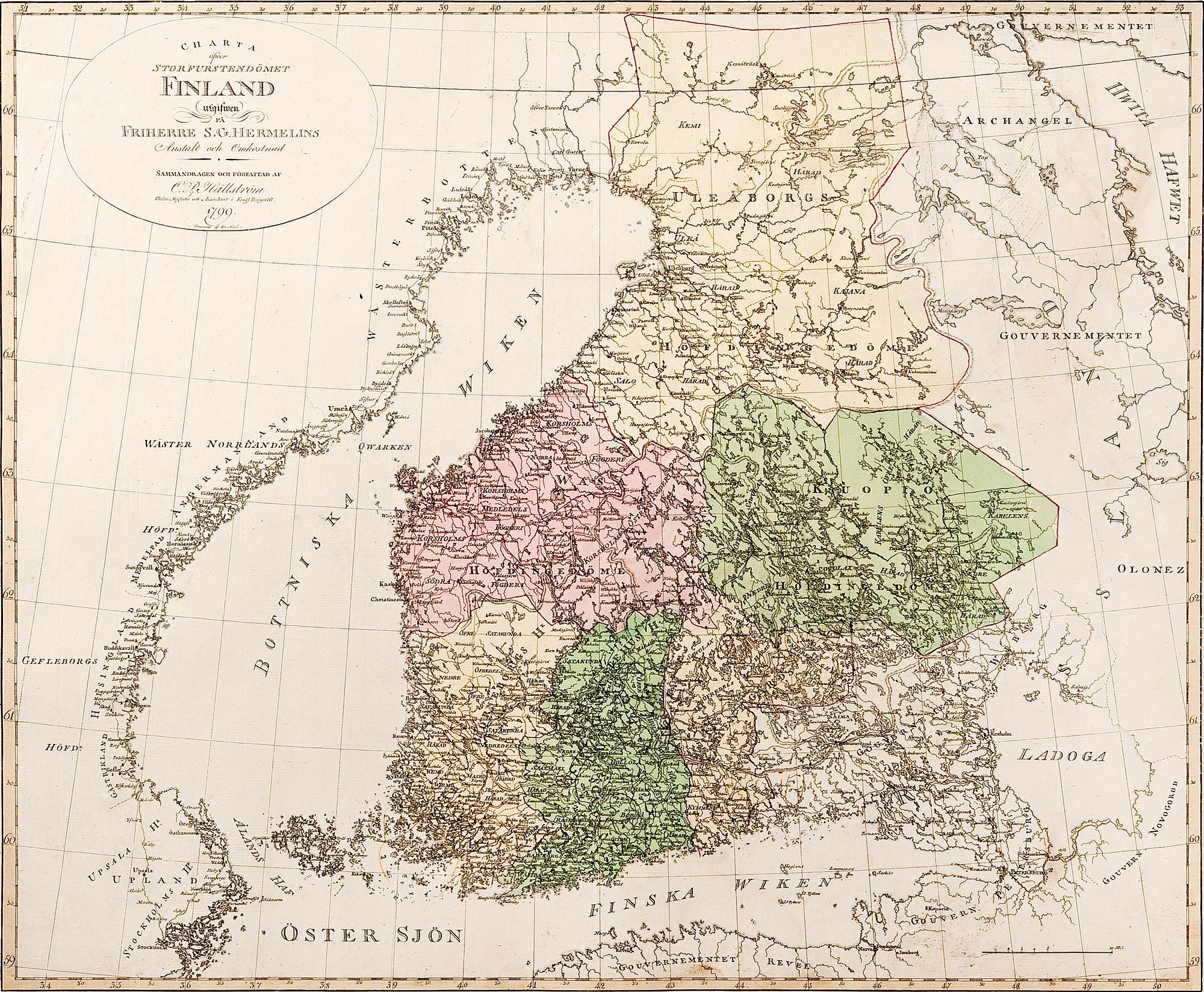
A MAP.
Charta öfwer storfurstendömet Finland 1799.
Hand-coloured engraving. 54 x 58 cm. Unframed.
More information
The map was compiled by the Finnish cartographer Carl Petter Hällström and was included in the first atlas over Finland, published by baron Samuel Gustaf Hermelin. The map shows the border with Russia and the administrative borders of the Grand Duchy.
Source: J. Strang & E.-S. Harju: Suomen karttakirja 1799. Porvoo 2005.