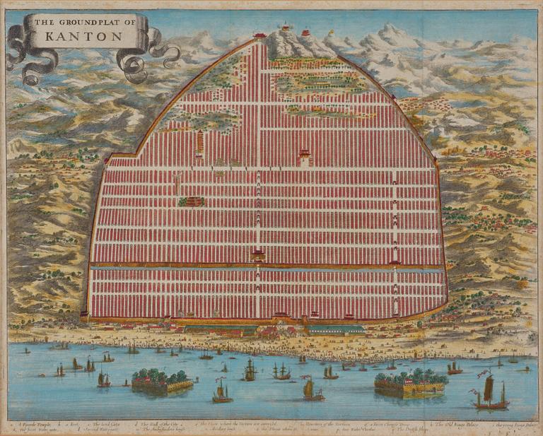
Map of Canton, engraving, 'The Groundplat of Canton', W. Bramston, 1840.
Map of Canton, engraving, 'The Groundplat of Canton', W. Bramston, 1840.
The Ground Plat of Canton. Map describing the city of Canton in the year 1840. W. Bramston, British Superintendent in Canton. Later coloured. Image area c. 29.5 x 36.5 cm. Frame 51 x 58.5 cm.
Not examined out of the frame. Stains. Creases.
Others have also viewed
14h 1m
A Chinese pendant ceiling light, first half/mid 20th century.
No bids
Estimate 250 EUR
6d 13h
Carpet, antique China, approx. 128 x 67 cm.
No bids
Estimate 2 500 SEK
3d 18h
Buddha, bronze. Burma, probably 20th century.
No bids
Estimate 2 500 SEK
2d 9h
Vase East Asia 20th century bronze.
Current bid 300 SEK
Estimate 2 500 SEK
2d 11h
Two blue and white dishes, Qing dynasty, Qianlong (1736-95).
Current bid 500 SEK
Estimate 3 000 SEK
2d 11h
A blue and white serving dish, Qingdynasty, Qianlong (1736-95).
Current bid 860 SEK
Estimate 2 500 SEK
15h 13m
Unidentified artist, so-called fan painting with landscape mounted in a frame with calligraphy, China, 20th century.
Current bid 300 SEK
Estimate 2 500 SEK
2d 9h
Sculpture East Asia 20th century.
Current bid 300 SEK
Estimate 2 500 SEK


