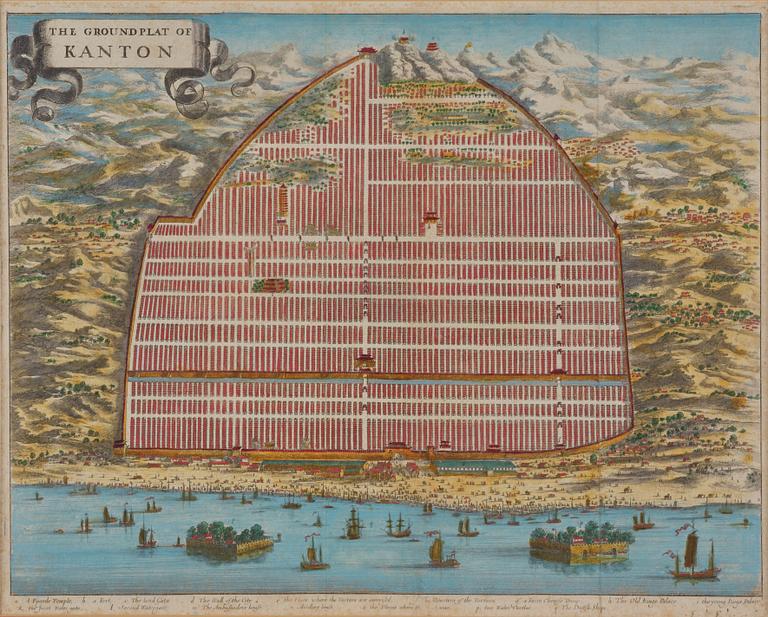
Map of Canton, engraving, 'The Groundplat of Canton', W. Bramston, 1840.
Map of Canton, engraving, 'The Groundplat of Canton', W. Bramston, 1840.
The Ground Plat of Canton. Map describing the city of Canton in the year 1840. W. Bramston, British Superintendent in Canton. Later coloured. Image area c. 29.5 x 36.5 cm. Frame 51 x 58.5 cm.
Not examined out of the frame. Stains. Creases.
Others have also viewed
6d 6h
A group of three red wooden vessels, China/Southeast Asia, 20th century.
No bids
Estimate 2 500 SEK
3d 6h
A Chinese famlle rose porcelain bowl, late Qing dynasty.
No bids
Estimate 2 500 SEK
3d 7h
Unidentified artist, two watercolour paintings, 20th century.
Current bid 500 SEK
Estimate 3 000 SEK
3d 6h
Unidentified artist, Two landscape paintings, China, 20th century.
Current bid 1 800 SEK
Estimate 2 500 SEK
6d 3h
Watercolour, signed Shisen, 20th century.
Current bid 600 SEK
Estimate 2 500 SEK
7h 28m
A Chinese reverse glass painting, 20th century.
Current bid 500 SEK
Estimate 3 000 SEK
3d 4h
A cabinet, China, circa 1900.
Current bid 2 000 SEK
Estimate 3 000 SEK
7h 10m
A Chinese reverse glass painting, 20th century.
Current bid 2 200 SEK
Estimate 4 000 SEK


