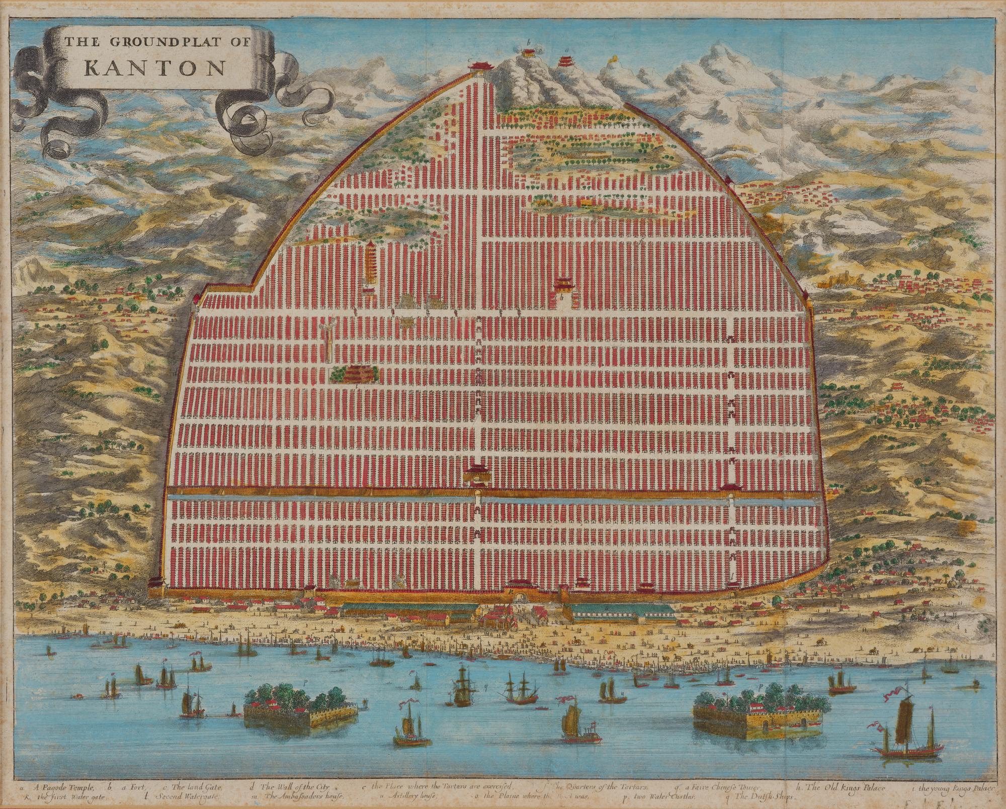
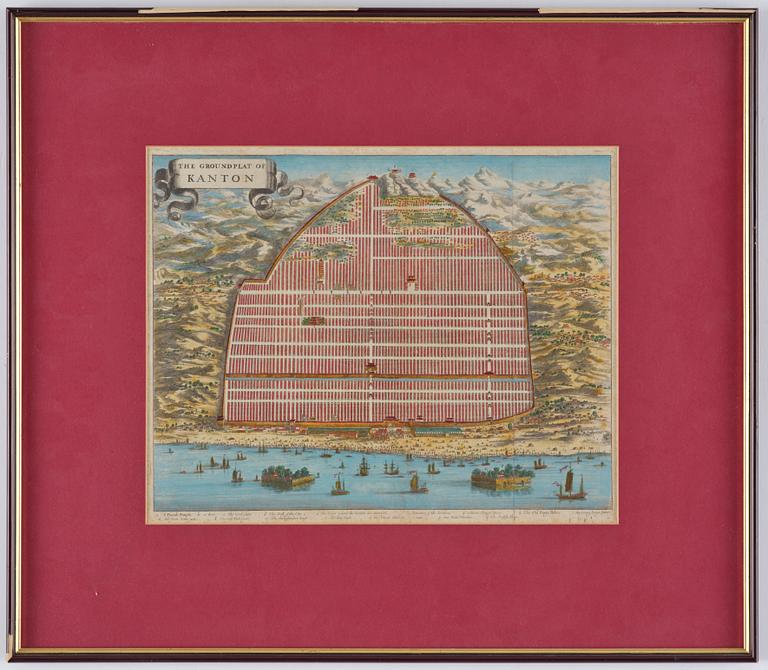
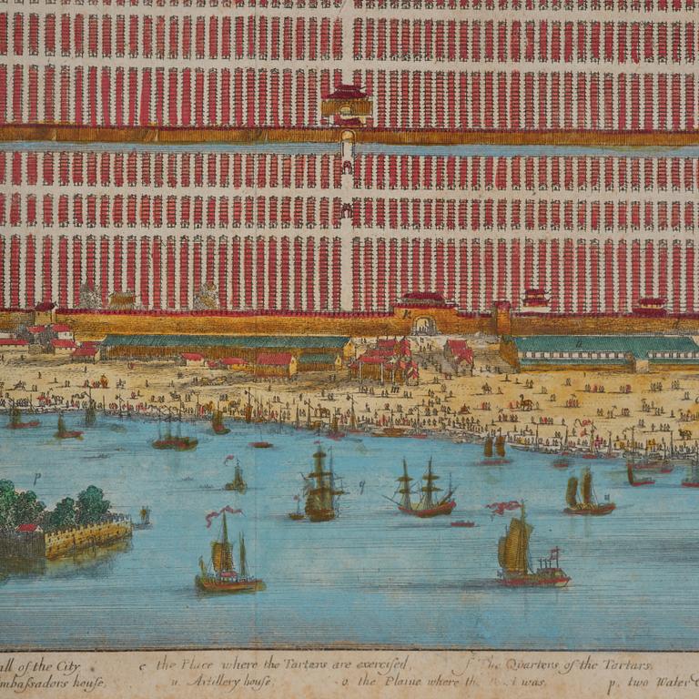
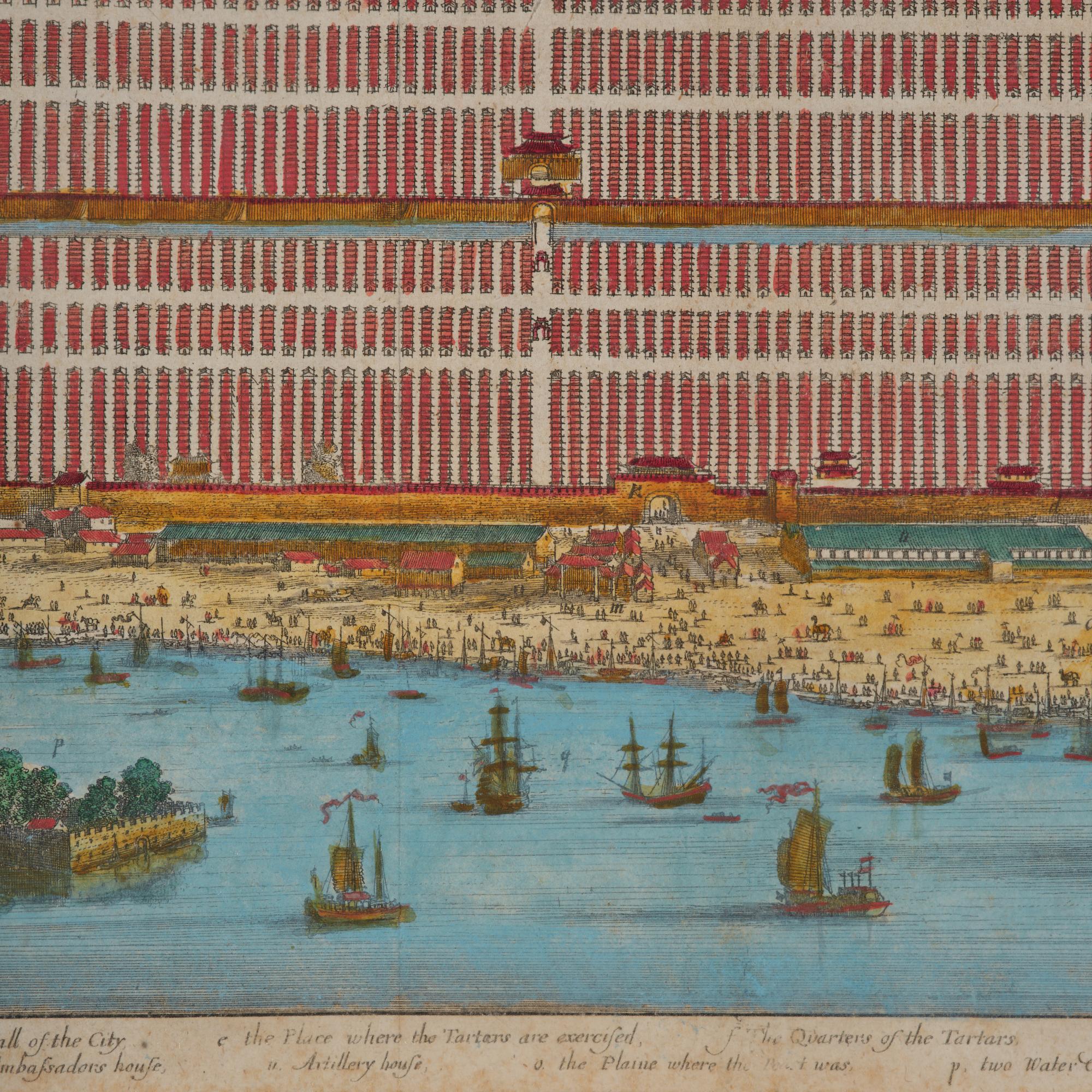
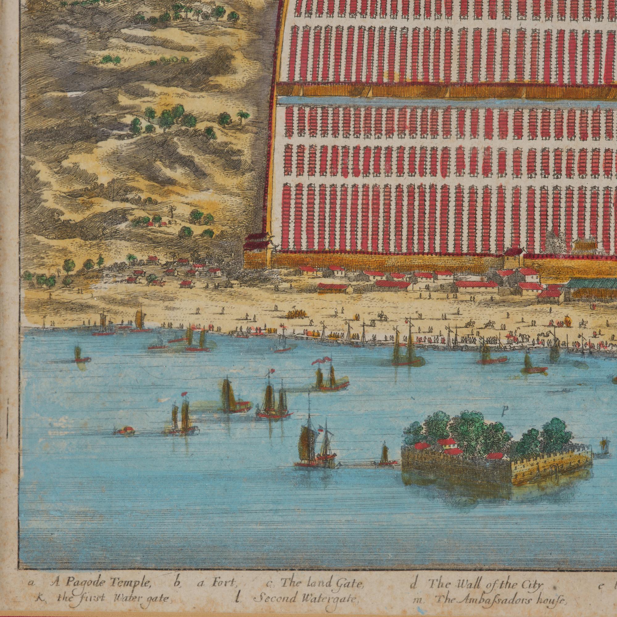
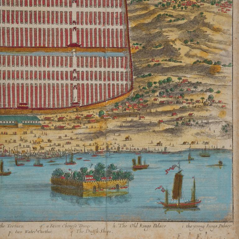
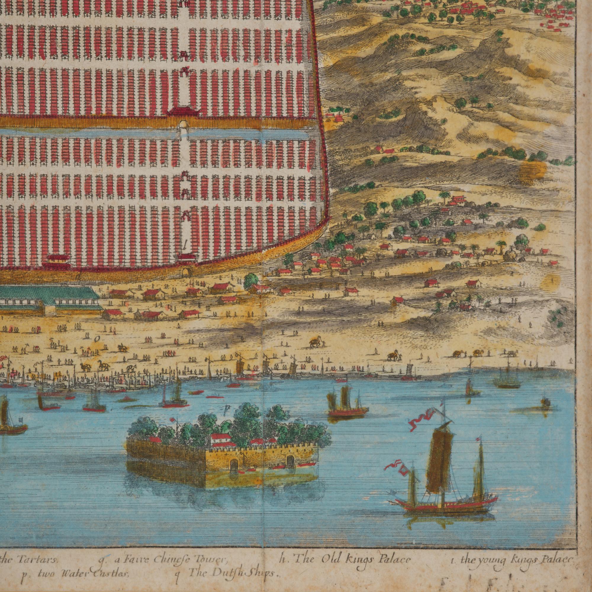
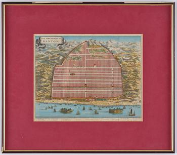
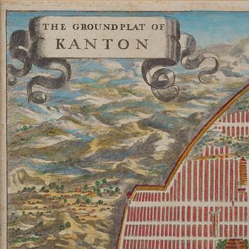
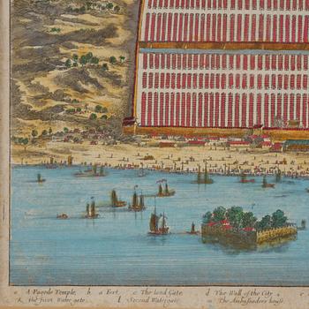
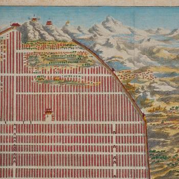
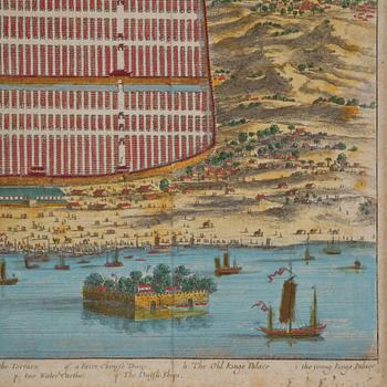
Map of Canton, engraving, 'The Groundplat of Canton', W. Bramston, 1840.
Auction ended
The Ground Plat of Canton. Map describing the city of Canton in the year 1840. W. Bramston, British Superintendent in Canton. Later coloured. Image area c. 29.5 x 36.5 cm. Frame 51 x 58.5 cm.
Not examined out of the frame. Stains. Creases.


Others have also viewed
1715579
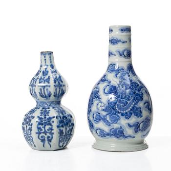
Two blue and white vases,
possible for the islamic market, Qing dynasty, 18/19th century.
No bids
4d 2h
Estimate
3 000 SEK
1715542
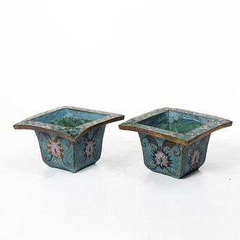
A pair of Chinese cloisonné on gilt copper flower pots,
late Qing dynasty / around 1900.
No bids
4d 2h
Estimate
2 500 SEK
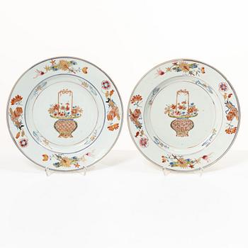
1718864
Two famille rose 'flower basket' dishes,
Qing dynasty, early 18th century.
No bids
9d 5h
Estimate
2 000 SEK