


Guillaume Delisle, map of Scandinavia and Iceland, Regner & Iosue Ottens, Amsterdam ca 1740.
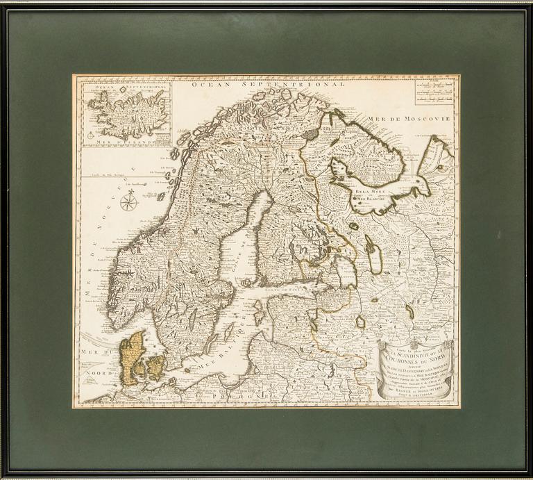

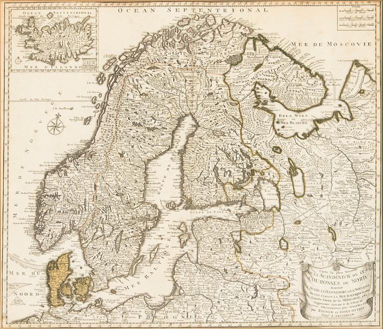
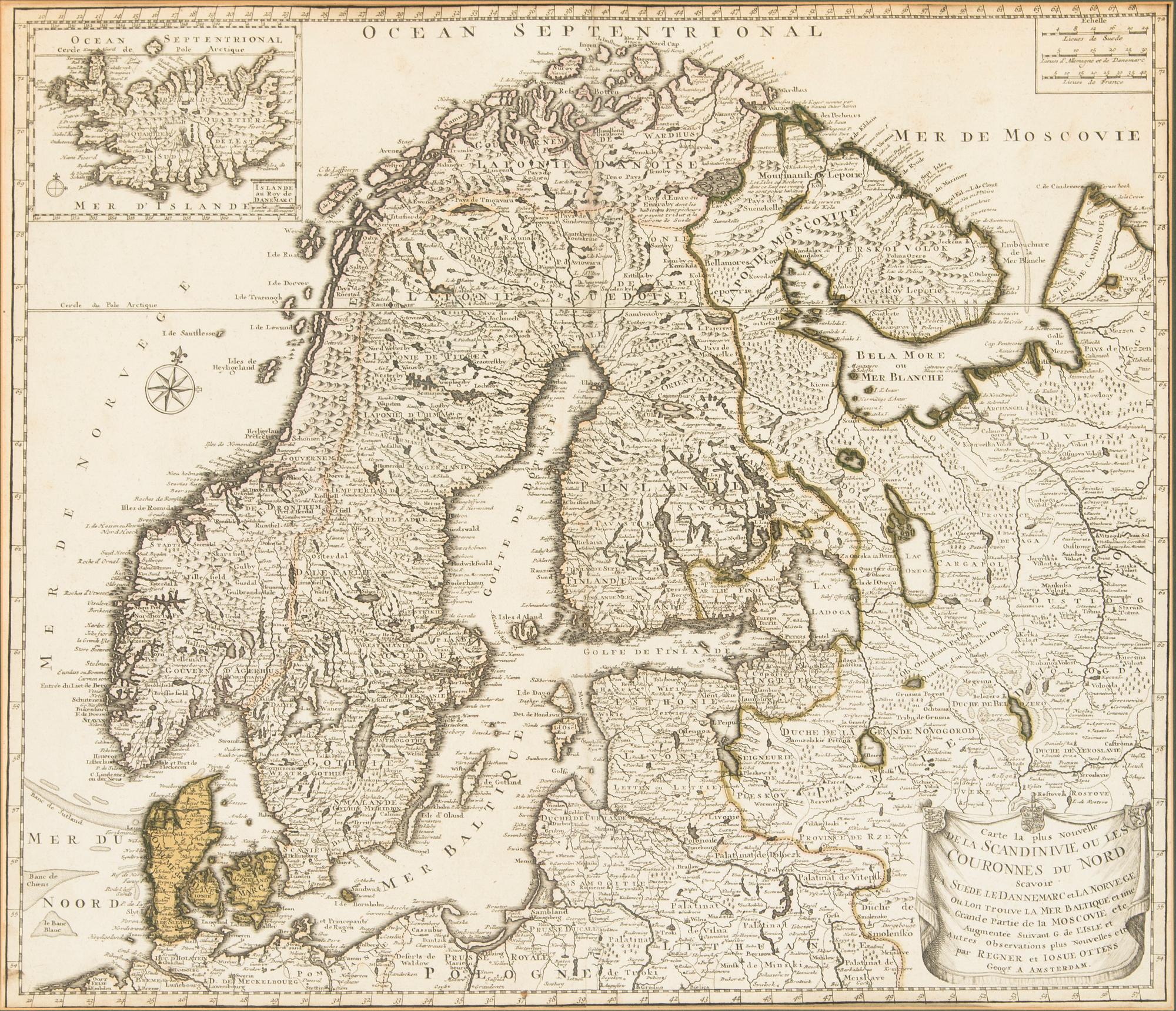
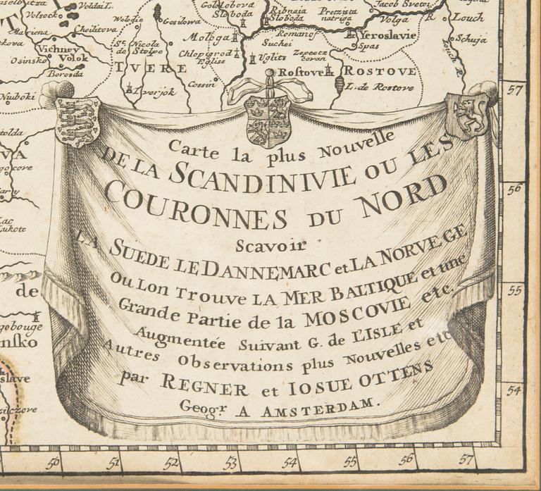

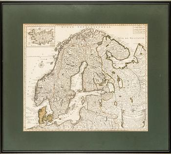
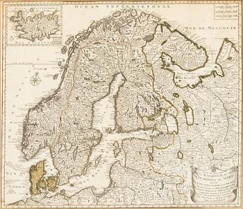
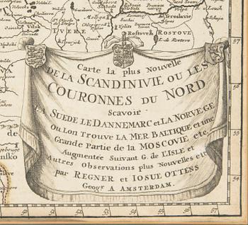
Hand-coloured copperplate engraving. Map of Scandinavia, the Baltic Sea and the neighbouring countries to the east, probably from Atlas Minor, also showing an inset map of Iceland in the upper left corner. The title in the lower right corner is surrounded by a draped cartouche with three types of arms. A decorative compass rose is depicted on the left and three distance scales in the upper right corner. Image size 51 x 59 cm.
Wear due to age and use. Minor stains. Usual centerfold with a minor tear at the bottom of the folding. Not examined out of frame.
More information
Guillaume Delisle (Paris, 1675 – 1726). One of the key figures in the development of French cartography, the son of Claude Delisle, a cartographer, and the half-brother of astronomers Joseph-Nicolas Delisle and Louis de l'Isle de la Croyère.